

In 2024, the Russian Academy of Sciences will celebrate its 300th anniversary with the rest of the country. The RAS development and history is inextricably bound up with expeditions. The first academic expeditions allowed scientists to describe for the first time a handful of regions and collect a wealth of materials about the flora and fauna, culture and history of different peoples. These collections enriched the country’s museums and started development of regional research areas. Irina Vladimirovna Tunkina, Corresponding Member of the Russian Academy of Sciences, Director of the Saint Petersburg Branch of the RAS Archives, talks about the history of expeditions and dramatic events that followed.
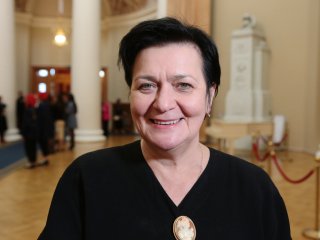
Irina Vladimirovna Tunkina, Dr. Sc. in History, Corresponding Member of the Russian Academy of Sciences, Director of the Saint Petersburg Branch of the RAS Archives.
— How were expeditionary activities conducted in Russia before the establishment of the Academy of Sciences?
— Before the academy was established, Russia invited Western European professionals to work as doctors, botanists to look for medicinal plants for medical purposes, pharmacists and chemists to manufacture medicines, naturalists to search for mineral waters. These tasks were delegated to Pharmaceutical Prikaz in Moscow that opened its branch – Pharmaceutical Chancery and Main Pharmacy – in 1707 in Saint Petersburg, the newly founded Russian capital. Just to recap, Russia became empire in 1721 after Peter declared himself an emperor.
It was Pharmaceutical Chancery (Medical Chancery from 1714 and Medical College from 1721) that was in charge of organizing expeditions across Russia – to North Caucasus, Karelia, Urals, and Siberia.
Robert Karlovich Areskin, also known as Robert Erskine, a Scottish personal physician to Tsar Peter the Great and a Fellow of the Royal Society of London (British Academy), was appointed to send invitations to foreign scientists. He invited professionals to come to Russia as he was well-connected with Western European universities, including the German University of Halle. It was there that the future president of the Academy of Sciences, physician in ordinary Lavrenty Lavrentievich Blumentrost studied.
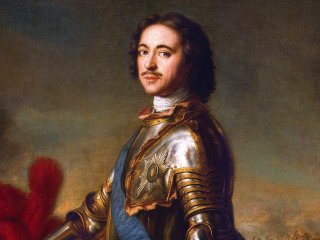
In 1718, Peter issued a His Imperial Majesty’s Edict to send a Pomeranian physician Daniel Gottlieb Messerschmidt who he had previously met in Danzig (now, Gdańsk) to Siberia to “collect rarities and medicinal plants.” During that era, Northeastern Eurasia was a complete mystery for science. Messerschmidt embarked on a journey at Moscow with a diplomat Lev Vasilievich Izmaylov who headed for China. They parted in Tobolsk. He wanted to visit China badly but he, however, was denied, as he was ordered to study the territory of the Russian remote regions. For eight years, the physician studied vast Siberian swathes practically alone, accompanied by dragoons. In the early stage of his expedition, he was assisted by Swedish and German prisoners of war (the so-called Karolingers) who eventually went back home in spring-fall 1722 under the Treaty of Nystad. Messerschmidt visited Cis-Urals, Southern and Western Siberia, Transbaikalia and reached the borders with China. The places that Messerschmidt had never had a chance to see, were then visited by academic teams of the Second Kamchatka Expedition (1733-1743) sent to Siberia in the first decades of the Academy of Sciences.
It has to be said that Messerschmidt was a true polymath. Virtually in a complete scientific solitude, he was the first to study and describe all realms of the Siberian nature and cultural and ethnographic artifacts – he studied paleontological artifacts (discovered mammoth bones), animals and plants, minerals, conducted barometric and meteorological observations, recorded vocabularies of local tribes, and amassed ethnographic and archaeological collections. The German physician compiled the first glossaries of the Siberian aboriginal population with equivalents in Latin and German. In January 1722, he ordered excavations of burial mounds in Khakassia. He discovered the medieval Orkhon Turkic writings on stone statues that were deciphered only 150 years later and several petroglyphs, most of which have not survived to this day. And all this without knowledge of any Russian. The researcher tried to study the language to no avail. Messerschmidt got help from interpreters from among the expedition’s service staff.
Messerschmidt sent his reports to Pharmaceutical Chancery in Saint Petersburg where Peter the Great founded the Academy of Sciences in 1724. New members of the academy were allowed to study his expeditionary materials. When Messerschmidt returned to Saint Petersburg in 1727, all his papers and collections he brought along were seized and handed over to the Kunstkamera.
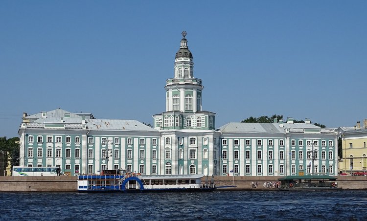
The Kunstkamera, view from the Neva. Author: Ad Meskens / Source: Wikipedia
— Why?
— Over a conflict with the Head of Pharmaceutical Chancery and personal physician to the Tsar Johann Deodat Blumentrost (elder brother of President of the Academy of Sciences L. L. Blumentrost) and a strong scientific interest of the day for the unexplored northeastern parts of Eurasia. The territory of Siberia was completely unknown and maps of these regions were classified. All notes of his journeys, all collections he brought along were sealed up and transferred to the Academy of Sciences and Kunstkamera in 1728 for studying. Messerschmidt was forbidden under oath to publish any of his collected materials. Unfortunately, the disastrous fire at the first Russian public academic museum in 1747 destroyed his collection and other exhibits. Only a handful of articles from Messerschmidt’s collection survived it.
In 2020–2022, the academic archives released a facsimile edition of Messerschmidt’s final manuscript Sibiria Perlustrata (Description of Siberia) composed in 1727, which remained unreleased for 300 years, and two volumes of notes on this manuscript. For all intents and purposes, this is an encyclopedic description of Siberia in Latin, the language of science in the 18th century. The scientist described botany, zoology, mineralogy, ethnography of the region, compiled vocabularies of different languages and drawings of archaeological sites, chiefly from the Minusinsk Hollow. Materials accumulated by the Messerschmidt Expedition were partly published only in the 1960s, in the source language, without any Russian translation. His findings show that he was a scientist of the Alexander von Humboldt caliber, yet totally forgotten. If von Humboldt is known throughout the world, D. G. Messerschmidt is familiar to only a chosen few researchers, although his contribution to scholarship is as much, if not greater.
— How important was it back then to have such encyclopedic knowledge like as Messerschmidt had?
— All science in the 18th century was actually encyclopedic. In Europe where science was promoted by Isaac Newton and Francis Bacon, Enlightenment scientists placed utmost importance on the science fact. In Russia, there was no secular-minded science catering to the specific needs of the state prior to Peter’s reign. Therefore, the tsar established the Academy of Sciences along with the gymnasium and university. The country needed an impetus to create a new educated elite. Opening of the Academy of Sciences was the last crucial building block in a series of Peter I’s reforms. Peter the Great, regretfully, could not see his creation working, as the first conferences (general meetings) of the academy members were held in September 1725.
— After Siberia, the second team left for the faraway Kamchatka Peninsula. Is there any evidence in what conditions the expedition was conducted and what results the scientists obtained?
— The Second Kamchatka Expedition can be considered the greatest undertaking of the Academy of Sciences in the 18th century. It was tasked to explore a vast part of Russia’s terra incognita of that time in the footsteps of the Messerschmidt Expedition – endless Siberia. Expeditionary teams copied Messerschmidt’s unreleased papers and went in his footsteps moving further northeast in Eurasia to Kamchatka and Alaska.
The world science of the first half of the 18th century was virtually clueless about these areas of the Russian Empire. One of the main questions was if there was a strait between Eurasia and North America. As it turned out, there was. Today, we know it as the Bering Strait. It was Vitus Bering who headed the First and Second Kamchatka Expeditions, although he perished during the latter. In addition to Siberia, his teams explored the Far East, discovered the aforementioned strait and described Alaska.
Another important task for the expedition was to create accurate maps, which did not exist at the time. Peter I tasked military surveyors with creating land maps of Russia. Originally, these efforts were supervised by the Senate. Once established, the Academy created its own Geographical Bureau (later, Geographical Department), the first centralized mapping agency in Russia and one of the first in the world. Joseph-Nicolas De L’Isle, a French astronomer and a member of the Academy, was appointed its director. Atop of the Kunstkamera tower, he set up an astronomical observatory that he headed.
Maps required some mathematical basis and engagement of astronomers, mathematicians, surveyors, artists, engravers, and translators. For example, we owe a debt of gratitude to I. S. Gorlitsky, a translator of the Academy, for many words – Russian variants of the astronomical terminology: sputnik (a satellite), Mlechny Put (the Milky Way), etc. In 1735, the Bureau welcomed Leonhard Euler, a distinguished Swiss mathematician and a member of the Academy. Thanks to cooperation between De L’Isle and Euler, much attention was paid to the mathematical basis of maps and astronomical coordinates for specific points to develop the country’s geodetic control network.
The problem was that De L’Isle received many different maps from different departments and agencies. At some point, he was suspected of copying secret maps of the Russian State. These suspicions turned out to be far from groundless. In 1747, De L’Isle returned to France and secretly took out original and copied maps of the 17th century – first half of the 18th century, including the maps compiled by Peter I’s surveyors, classified source maps of the Second Kamchatka Expedition and other expeditions, notes on journeys, descriptions of voyages, etc. These papers are now available at the Department of Maps and Atlases of the National Library of France.
— How did the administration of the Academy react?
— Joseph-Nicolas De L’Isle who robbed Russia was stripped off the honorary membership of the Saint Petersburg Academy of Sciences and no longer paid a wage. Instead, however, he received a life pension from Louis XV for bringing from Russia a collection of original secret maps that the French government purchased by the Royal decree.
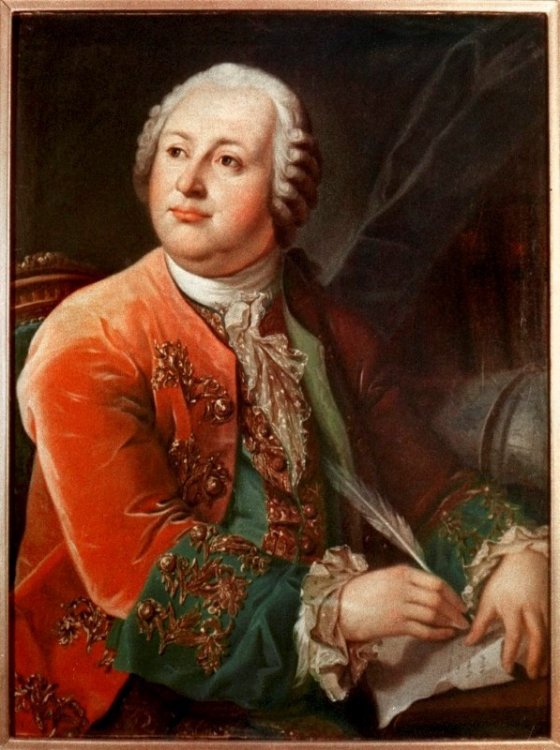
Portrait of M.V. Lomonosov. Copy of L.S. Miropolsky from the work of G.K. von Prenner 1787 St. Petersburg. MAE RAS. Source: Wikipedia
— We know that the Geographical Department was also headed by Mikhail Vasilievich Lomonosov. How did he influence the development of the Academy’s expeditionary activities?
— The Imperial Court was very unhappy with De L’Isle, as you understand. Empress Elizabeth was shocked by the situation at hand. Which is why, she appointed Lomonosov Head of the Geographical Department. But when Catherine the Great rose to power, Lomonosov’s enemies went to great lengths to have him removed from office. In 1763, for example, she signed two decrees: one to award Lomonosov a rank and the other to dismiss him, the latter was fortunately revoked some time afterward. Lomonosov headed the department until his death.
He was faced with the most important task to keep secret information about Russian territories and improve maps for practical needs of his own country. After all, what are maps? These are new land and sea trade routes that had to be hidden from other European powers.
The engraved academic Russian Atlas was released thanks in no small part to the Geographical Department. It was published in 1745 with explanatory texts in Russian, Latin, German, and French. The first academic atlas was made as a general map of the Russian Empire with individual maps of 19 governorates. Later on, Mikhail Lomonosov corrected De L’Isle’s atlas by sending questionnaires to governorates to get more accurate data and alter cartographic information. In the second half of the 18th century, successes in mathematics, astronomy and geodesy, including the invention of triangulation, improvements in measurement tools, use of relief lining by Johann Lehmann’s method (1799), which allowed scientists to show slope angles on the maps, contributed to further development of the science-based approach to cartographic tasks.
By then, the country needed large-scale surveying and mapping works. Such mapping works were carried out by different institutions using different methods and for different purposes gradually departing from purely scientific requirements. In 1766, Russia commenced the Ordnance Survey (1766–1843) of its lands supervised by the Senate. In 1762, Catherine II established the General Staff that, one year later, was ordered to compile special maps of the empire chiefly for the army and fleet use. From then on, maps were accumulated at the Military and Topographic Depot, all the while the Geographical Department of the Academy of Sciences during the reign of Paul I was closed down after the emperor introduced mandatory censorship for printed maps.
— How did academic expeditions go in the 19th and 20th centuries?
— In an age of intense specialization of scientific disciplines, the Academy of Sciences organized many expeditions to explore different regions of the empire and other continents. Their participants studied botany, geology, zoology, archaeology, ethnography, linguistics, and other sciences in much detail. A summary description of expeditions dating back to that period is available in the remarkable book by Soviet archiver Vera Fyodorovna Gnucheva who died during the Leningrad Blockade – Materials for the History of Expeditions of the Academy of Sciences in the 18th and 19th Centuries: Chronological Reviews and Description of Archive Materials, now available on the archives’ website. Unfortunately, the book has only a partial list of expeditions. For example, the author leaves out the 20th century when expeditionary bases were set up in different regions, which would then set the stage for research centers and academic branches: Siberian, Ural, and Far Eastern.
What made the expeditionary activity in the 19th and 20th centuries so special was the organization of expeditions all over the world. Among them was the First Russian Expedition to Brazil organized by Grigory Ivanovich Langsdorf, also known as Georg Heinrich von Langsdorff (1821–1829). Sad to say but his expedition’s materials were forgotten for 100 years. In Brazil, he contracted jungle fever and almost went crazy. The Langsdorff Expedition’s materials remained unreleased and were rediscovered only before World War I. They contain sensationally accurate drawings made by the expedition artists – around 400 watercolor paintings that are currently kept at our archives.
Nestor Gavrilovich Rubtsov, a navigation professional, served as a hydrographer of the Langsdorff Expedition. His maps are now available at the Russian State Archives of the Russian Navy. By the way, there was an experiment when Google Earth images were superimposed on Rubtsov’s maps for comparison and, believe it or not, they were a complete match. I mean, the accuracy of the hydrographical and cartographic survey in Russia in the first quarter of the 19th century reached amazing heights. Let me emphasize that this was due in part to the fact that the maps creation at the turn of the 18th and 19th centuries was transferred from the Academy of Sciences, which developed the principles for creating a mathematical basis for maps, to military departments and agencies: military and topographic and hydrographical depots.
— What are the most invaluable exhibits telling about the expeditionary activities that the RAS Archives have in their storage?
— There are a lot of documents like that. Let me tell you about our recent discovery. The Archives are the storage for the collection of the Russian Archaeological Institute of Constantinople (Istanbul, Turkey), the first and only Russian research institution established abroad to study history, archaeology, and arts of the Christian East. It launched expeditions to different parts of the Ottoman Empire. Founded in 1895, this institute worked until 1914 when Russia severed diplomatic relationship with Turkey after the outbreak of World War I. Archival and museum collections were gradually returned to the Soviet Union until early 1930s. The institute materials were divided, as museum collections were sent to the Hermitage, documents – to the Russian State Historical Archive, Archives of the Academy of Sciences of USSR, RAS Scientific Archive of the Institute for the History of Material Culture and its collection of ancient manuscripts found its way into the Research Department of Manuscripts of the RAS Library.
Among these documents was a collection of estampages – impressions of inscriptions in ancient and medieval languages gathered all over the Ottoman Empire. One of these estampages, which, as it became evident, was made off an unknown article, turned out to be the impression of an inscription in the Northwest Semitic language dating back to the middle of the 9th century BC. The discovery and publication of this inscription became a worldwide sensation, as it was the world’s second oldest inscription, apparently originating from Southern Judea. That is, we are talking about the emerging language of the Bible. The findings were published in The Journal of Ancient History (2022. #4). If you are interested, you can read our article in English. Sometimes, you just don’t know what scientific discoveries a collection can bring.
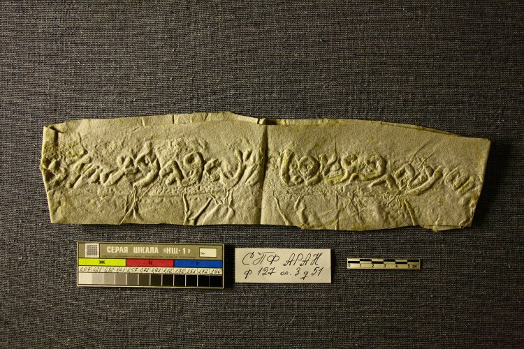
Northwest Semitic inscription. Mid-9th century BC. In Northwest Semitic language. Source: SPBB RASA. Collection 127. List of Files 3. File 51. Folio 1. Author: L.G. Chehovich
— Very interesting! Irina Vladimirovna, what are working on today?
— Only recently, we have completed a major work on Messerschmidt dedicated to the study of his scientific legacy. Starting from 2011, we were assisted by a member of the Göttingen Academy of Sciences, the then Vice President of that academy, Werner Lehfeldt. In 2022, he was elected a foreign member of the Russian Academy of Sciences. He helped us a lot, as documents of the 18th and 19th centuries were available in the German Gothic Cursive Calligraphy, which only a handful of scientists can read now. Even minutes of conferences (general meetings) of the Academy of Sciences from the date of its foundation to the 1860s were taken in Latin, German, and then French, as most academy members came from foreign countries. Werner Lehfeldt joined us to study Messerschmidt’s scientific legacy and wrote a detailed researcher's biography that will be released in German in Göttingen in 2023. In partnership with Lehfeldt, we published a collection of documents about the first stage of the expedition undertaken by Siberian pioneer Messerschmidt and in 2022, we released a series of books featuring Werner Lehfeldt.
Today, we are preparing to celebrate the 300th anniversary of the Russian Academy of Sciences. The Archives are drafting two volumes about the 210 years of the academy’s stay in Saint Petersburg and the RAS Archives in Moscow – from 1934 to date. It’s a Herculean task. And very interesting!
Photo on the page: screenshot of the House of Scientists program, St. Petersburg State Television and Radio Broadcasting Company, 2022
Main page photo: Russian Atlas (1745), digital copy made by the Russian State Library / Wikipedia


.jpg)
.jpg)